Champagne Reef
Dive site off Dominica’s west coast. Here's what has been recorded at this site month by month, how the region’s reefs have weathered ocean heat, and how to prepare.
Champagne Reef: dive site off Dominica’s west coast.
Entry
Entry points, depths, currents and any local rules will be added once we can verify them from official sources.
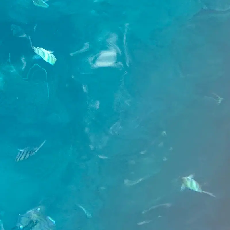
At this sitegeotagged 417 m from the site coordinates Atlantic sergeant major (Abudefduf saxatilis) · jimsox · CC BY 4.0 · iNaturalist
The surface noise falls away.
Reds go first. The world turns blue-green.
Then Champagne Reef rises to meet you.
What lives here, by month
Pick a month. These are the species most often recorded within about a kilometre in that month, from open survey records.
| Species | Jan | Feb | Mar | Apr | May | Jun | Jul | Aug | Sep | Oct | Nov | Dec |
|---|---|---|---|---|---|---|---|---|---|---|---|---|
| Broadsaddle Cardinalfish | ||||||||||||
| Black Brotula | ||||||||||||
| Spotfin Goby | ||||||||||||
| Candy Basslet | ||||||||||||
| Caribbean Snow Bass | ||||||||||||
| Sally Lightfoot crab | ||||||||||||
| Cave Bass | ||||||||||||
| Orangeback Bass | ||||||||||||
| Sawcheek Cardinalfish | ||||||||||||
| Flamefish | ||||||||||||
| Striped Cardinalfish | ||||||||||||
| Bayerotrochus pyramus |
Most-recorded species, all months
- Broadsaddle Cardinalfish (7)
- Black Brotula (4)
- Sally Lightfoot crab (3)
- Spotfin Goby (3)
- Candy Basslet (3)
- Caribbean Snow Bass (3)
- Cave Bass (2)
- Orangeback Bass (2)
- Sergeant Major (2)
- Sawcheek Cardinalfish (2)
- Flamefish (2)
- Striped Cardinalfish (2)
- Bayerotrochus pyramus (2)
- Polylepion gilmorei (1)
- Bigarm river shrimp (1)
- Marbled swimcrab (1)
- Furcate spider crab (1)
- Batwing coral crab (1)
- Rhizosmilia gerdae (1)
- Yellowline Arrow Crab (1)
GBIF.org (2026-10-15), occurrence records within ~1 km, licensed CC0 or CC BY 4.0 only. Birds and land animals are excluded. Counts reflect survey effort, not abundance. 3,708 qualifying records. See them on GBIF. Common names: Wikidata (CC0) / GBIF. Species photos: Wikimedia Commons, credited with each species.
Forty-one summers of heat
Each stripe is one year since 1985, colored by its peak heat stress across NOAA's “Leeward Caribbean Islands” region. These are NOAA Coral Reef Watch satellite figures for the whole region, not for this one site.
Heat stress, measured from orbit.
NOAA CRW virtual station “Leeward Caribbean Islands”. NOAA's alert thresholds are 4 °C-weeks (Alert Level 1) and 8 °C-weeks (Alert Level 2). Station page · Method. Credit: NOAA Coral Reef Watch.
Conditions
Average sea temperature through the year. Check the live readings before you go.
Average sea surface temperature by month: NOAA CRW “Leeward Caribbean Islands” station climatology (monthly means).
Buoy readings are measurements; forecasts are models. Use them for planning only, and assess conditions on site. Depth and visibility data aren't listed until we can cite a source.
Plan & prepare
- Read the official marine forecast the night before.Offshore, wind and sea state decide the day.
- Confirm access, hours and any fees with the site.[Placeholder: verified operator list to come]
- Study this month's species above.You'll recognise more when you know the names.
- Hands off, fins up, buoyancy dialled. Log what you see.Your sightings can become tomorrow's open data.
Credits
- Coordinates
- Wikidata Q19879397 (CC0) · position of Champagne Beach. OpenStreetMap (ODbL) dive-site nodes on the northwest coast; the Soufrière–Scotts Head sites use Wikidata (CC0) positions of the nearby beach or headland, so they are approximate.
- Species records
- GBIF.org, CC0 & CC BY 4.0 records. By license: CC_BY_4_0: 3,621, CC0_1_0: 87
- Dataset
- EOD – eBird Observation Dataset · doi:10.15468/aomfnb (3,504 records) · GBIF
- Dataset
- iNaturalist Research-grade Observations · doi:10.15468/ab3s5x (53 records) · GBIF
- Dataset
- NABU|naturgucker · doi:10.15468/uc1apo (34 records) · GBIF
- Dataset
- Royal Ontario Museum - Mammalogy · doi:10.5886/gdcfc8 (32 records) · GBIF
- Dataset
- NMNH Extant Specimen Records (USNM, US) · doi:10.15468/hnhrg3 (26 records) · GBIF
- Dataset
- Birda - Global Observation Dataset · doi:10.15468/6kud7x (24 records) · GBIF
- Dataset
- NMNH Material Samples (USNM) · doi:10.15468/jb9tdf (14 records) · GBIF
- Dataset
- Field Museum of Natural History (Zoology) Mammal Collection · doi:10.15468/n4zgxw (5 records) · GBIF
- Query
- https://api.gbif.org/v1/occurrence/search?decimalLatitude=15.284,15.304&decimalLongitude=-61.394999999999996,-61.375&license=CC0_1_0&license=CC_BY_4_0&taxonKey=44&taxonKey=206&taxonKey=229&taxonKey=136&taxonKey=225&occurrenceStatus=PRESENT&limit=0
- Heat stress & SST
- NOAA Coral Reef Watch, 5 km Regional Virtual Station “Leeward Caribbean Islands”
- Hero photo
- At this sitegeotagged 417 m from the site coordinates Atlantic sergeant major (Abudefduf saxatilis) · jimsox · CC BY 4.0 · iNaturalist
- Species photos
- Wikimedia Commons, credited with each species. Full list: Data & sources